The following is primarily picture documentation with a few explanations.
Day 2 began with a hike up to the Fulford Cave after some breakfast.
Warming up.
This cave was pretty crazy. It had two entrances; a natural one with a 30ft-ish drop straight down, or this man-made culvert that basically descended into pitch darkness.
There's David, fearlessly taking the lead. I had serious doubts about going into a confined space where I couldn't see the end, but when my 5 year old son hopped in with no hesitation, I had to go along for support.
It was chilly in there. Ice formations were all over the floor.
Awesome formations on the walls.
As you can tell from the above picture, Gabe was ready to be out of there after 30 minutes underground. I couldn't blame him.
The guys got off to a good day's worth of riding after the caving experience. The weather was beautiful that morning.
The 2nd day of trails took the guys through a lot of sage-brush looking terrain.
We met up near a prime rafting/tubing area and Gabe got in his one swim of the trip. He loves swimming.
Taking a break along the creek.
The next section of trail was fit for my 2 wheel drive truck to travel. I wasn't so sure about it at first, but it was just wide enough and smooth enough for us to make it. The scenery was beautiful.
Notice the clouds forming up again?
There was nothing to be done but go through this stream at the end of a long, slow trail. I wasn't sure we would make it across. Fortunately, it wasn't like a muddy Kansas stream, and the pebbly bottom held us up. The only problem was that my electric windows wouldn't go back up afterward. Then it started to rain!
After the last section, we decided to stop at a tiny town and get dry/filled up. Can't remember the name of this little diner, but it had delicious soup and jalepeno hashbrowns. Gabe opted for the cheesy broccoli.
Made it to our next camping spot for night number 2. As you can tell from the rain gear, it started raining about as soon as we got set up.
A really tired little guy. He asked to lay down at 7:00pm and fell to sleep immediately!
The Trip
This past summer (2014) I was fortunate to be invited along a dirt biking trip as "Chuck-Wagon" support. Two of my high school buddies had off road tour bikes and wanted to take a second shot at riding as much of the CBDR (Colorado Backcountry Discovery Route) as possible. The CBDR is a back-country route that stretches from the Southern border of Colorado (It begins at the 4 corners) and stretches through the middle of the state all the way to Wyoming! Above is a shot of the entire route:
We had only three days to ride so the plan was to start near the middle, around Buena Vista (#10 on the map) The entire route is around 670 miles, so we were aiming to hit about half of it, averaging about 100 miles/day.
My job, which I happily obliged to do, was to drive ahead with the truck and trailer, set up camp, and have a hot supper ready for the guys when they finished that day's section of riding. I could take a more direct route to the next stop while driving on well-paved roads, so we assumed I'd beat them to the next spot with plenty of time to spare and they would have a moving supply truck waiting in case they needed something along the way. I was happy with this because it meant I would have some free time in Colorado to fish, hike, and just enjoy the outdoors! I asked my oldest son (who was 5 at the time) if he'd like to come along and join me in all of this. He made my day when he replied with an enthusiastic 'That'd be awesome!'"
The morning of our departure, July 10th at 6 am. Slight drizzle with rain in the forecast. Hopefully Colorado will be drier?
First stop for gas; still in Kansas! No rain here, but notice how heavy the back of the truck looks. The normal gas mile-age average of 12-14 would have looked a lot better than the 9mpg we got heading into the Mountains.
We made it to Buena Vista! The route started (for us) at an OHV area with a sandy trail made for all sorts of all terrain vehicles.
It took us a while to figure out this ancient piece of literature. Apparently fancy schmancy GPS only suggests "Reasonable" routes. We weren't looking for those.
If you were looking for a great place to camp in Colorado while having some fun with your 4X4 or whatever, this place had plenty of space to explore with the conveniences of a town close by.
Getting started young. Not sure if that's the "I really don't trust you" face or "I'm tired of riding in a truck for 7 hrs" face. The moment of truth. Cory and David are heading out prepared for almost whatever they can imagine. You may notice the 'slight' cloud-cover and darkening skies. This is what we call 'literal foreshadowing'. We felt pretty confident we'd meet up again in about 4-5 hours.
The county highway near Buena Vista was an amazing drive. This one-lane road that looked like it could have been dynamited just a few days ago.
The PLAN, PLAN B, and Was There a PLAN C?
At this point, the plan was to rendezvous at a camp-site near Eagle, CO which was about 100 miles away following traditional roads. I assumed the truck would take about two hours to get there while the guys would take four or five on their bikes. This could have easily been the case if the weather were normal, but as mentioned earlier, the clouds had been gathering and were threatening rain. I drove through several downpours as I traveled on HWY 24 and then onto I-70. Rain was the least of my worries due to plenty of lightning seen along my route. I knew that the guys were in serious danger of getting struck because they were traveling over three separate passes. Here is an excerpt from the COBDR website regarding this leg of the trip:
"Heading north, riders will traverse three major alpine passes on your
way to the high desert landscape of Gypsum. Weston Pass is the first and
has no major obstacles. Haggarman Pass is typical of Colorado’s backcountry,
offering stunning views of the rugged alpine tundra. After descending
into the Fryingpan River valley for a short stint on black top, the
route heads North again over Crooked Creek Pass."
All three passes top out over 10,000 ft with the first two reaching almost 12,000. In my limited experience battling Colorado's elements, warnings of the greatest threat to life have always been lightning strikes. This was beginning to weigh on my mind.
Driving to Eagle, Colorado wasn't a challenge but finding the vague agree-upon campsite in an unfamiliar campground was another ordeal. As you can see from the map below, the campsite was only 17 miles from the town of Eagle; but Google Maps suggests over an hour to drive there.
This, I found, through personal experience was no exaggeration. The path to our campground was fraught with potholes, hairpin turns, (small) river crossings, and over-all rough terrain. Add to all of that rain along with the onset of darkness and you can see how our nerves would begin to be tested.
Gabriel (my son) and I found that instead of only a few simple campsites, there were a plethora of campsites spaced out along many different branches within White River National Forest. However, after driving our way up and up through the Aspen-laden woods, we were rewarded with finding a beautiful campsite at the absolute FARTHEST point into the campground. Given that we hadn't agreed upon an exact camping spot, I figured if the guys couldn't find me, they'd at least travel to the furthest spot within the National Forest to look for my truck. Here's a view from the cliff right behind our tent:
Gabriel and I set up camp and unloaded the truck. We figured we could get supper ready pretty quick, but with all the rain, there was very little dry wood laying around and our flame kept going out. By this time, the hour for Cory and David to arrive had come and passed, so I began to think about possible scenarios for them being late. We figured upon them showing up between 7-8 pm and hadn't started supper yet because of the fire not getting going. Around 8:30 I tried giving them a call on our cell phones. As you would expect, there was no service in this area. Absolutely none. I searched high and low for a signal but to no avail.
Kind of like that.
I left a message, but knew they probably wouldn't get it while on their motorcycles. After another half hour, I decided to make a change. We had agreed that if everything went south, we'd meet at the Hospital in the town of Eagle. What we hadn't known was that it would take an hour of driving to get from the campsite to Eagle. I tried determining if it'd be better to stay and wait, or head to the designated back-up spot. I decided to try a few more texts in the hopes they'd get through, but again, there was no luck. At 9:15 I began to feel what I can only describe as panic. There was no light left, a steady drizzle was falling, and thunder continued to rumble through the mountains. My tired and hungry son was waiting on me to either put him to bed or pack him up and track down my friends and amidst it all there were ten different scenarios playing through my head about what could have happened to Cory and David. Only one of them appeared to end well. Every bad situation, from bad to worse, raced through my mind and gave me perhaps the most ominous feeling of tragedy that I've ever felt. I seriously thought I was going to have to tell their wives that they'd died on this trip away from their families. Here is a sample of the texts I sent that night:
6:34 pm-"All the way up near Fulford Cave campgrounds.....picking a spot."
9:09 pm-"Are you guys ok? Need you to text me when possible."
9:10 pm-"Sittting at Sinclair in Eagle for 10 more min."
9:22 pm-"Heading back to the camp site."
-No Responses
I had decided to take Gabe into Eagle (Another hour away from the campsite) while leaving the trailer and tent at the camp ground in case the guys got in late and came looking for me. Gabe could tell I was nervous and kept asking me if they were ok. I had to tell him "I don't know" and then asked if we could pray for them. Gabe started off by asking God to not let them be dead. I agreed.
After waiting in Eagle and not seeing anything (It was raining again at this time) I decided to head back to camp and wait until the morning to call search and rescue. Part of me wanted to call their wives and ask if they'd heard from them, but looking back, I'm glad I didn't because when I made the One hour trip back to camp, this is the first thing I saw:
The relief I felt was overwhelming. At least one motorcycle was there and that meant we could finally find out what happened. It turned out that the weather slowed them down a LOT because it made the rocks slippery and fogged up their goggles and helmet visors. The reason for only one motorcycle was that they had arrived at camp within 15 minutes of me departing and David decided to go looking for me! Somehow, we had avoided each other in all of our crossing paths. Fortunately, he showed up about 30 minutes later and was relieved to see me back as well. I've never been so relieved and happy to see these guys. We all (3 men and a kid) slept in that three man tent and it didn't matter that we had to dodge each other's elbows and knees. We were just glad to have made it through that day alive.
The Trail: Day 1
Following our harrowing 1st day, there was far less excitement of the anxious kind, and that was just fine. Here are some of the more enjoyable memories from that first day of riding:
I believe the stop for gas was in Leadville. The CBDR crisscrossed through towns and back-country.
There were a few water crossings.
Some of us got a little tired on the windy roads through the mountains.
These biscuits and gravy were supposed to be made over the fire, but this coleman grill kept us fed. It works even with regular gasoline!
Part 2 and the conclusion of our trip will come soon!

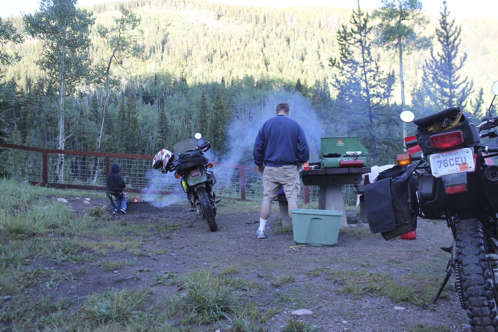


 These biscuits and gravy were supposed to be made over the fire, but this